We left Orange Beach on the 22nd as planned. We checked the weather, the flood levels and the waves on Mobile Bay. All looked good.
Bye Kay and Jim, thanks for the farewell dinner and we’ll see you on your travels north.
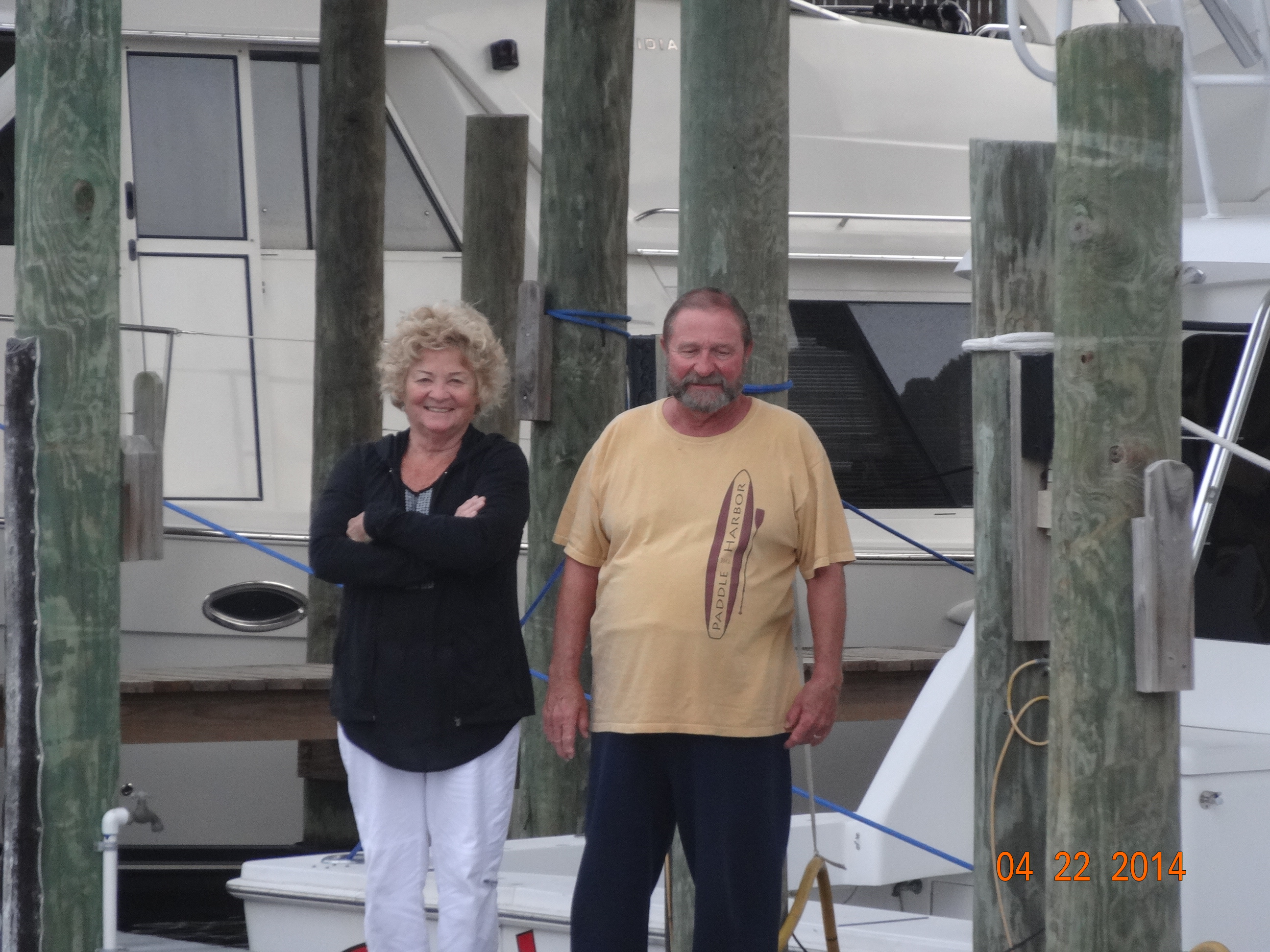
Kay and Jim
We left Orange Beach at 7:10. Following the markers and our “bread Crumbs” (for those of you who don’t remember, the bread crumbs is the tracking our boat made on its travels down to Orange Beach on our Garmin). Gary, shouldn’t we be on the other side of that marker? Whoops! I guess we have to get back into the program and pay more attention. A few extra electronics to look at on the way back. Hopefully they will come in handy.
We were traveling along at our usual pace when we were passed by a big sport fisherman, he slowed down for us but his wake was still huge. Knocked over a few lamps and opened a few drawers…..more practicing needed on hitting those wakes.
We make it to Mobile Bay and the waters are pretty smooth. I guess little Smokie has to get his sea legs again, he puked up his breakfast. Poor Smokie :(. We are trying the new short cut we learned about, it is suppose to cut off 10 miles. That will save some fuel and time. We even got to use our auto pilot, which is exactly like it sounds. We set a course, hit a button and the boat drives it self staying on the course we have set. When you are in rough seas, using auto pilot makes for a smoother ride.
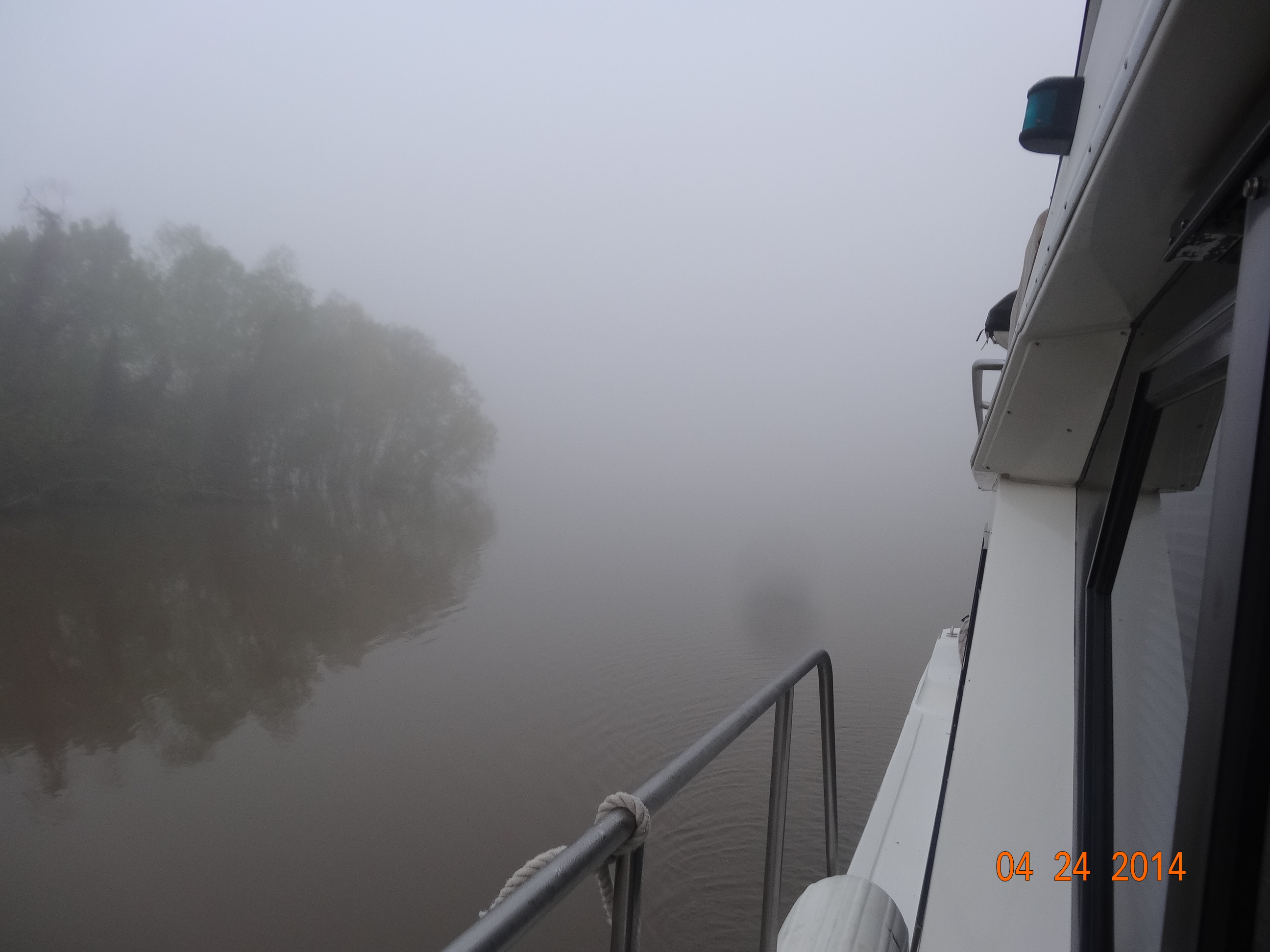
Our first stop was Dog River Marina where we stayed the night and filled up on fuel. We got a good price there. We also pumped out. It took as long to pump out as it did to put on fuel. I guess we had a lot of poop to pump 🙂 We left Dog River on the 23rd at 7:00. It is a little foggy out but the visibility is pretty good
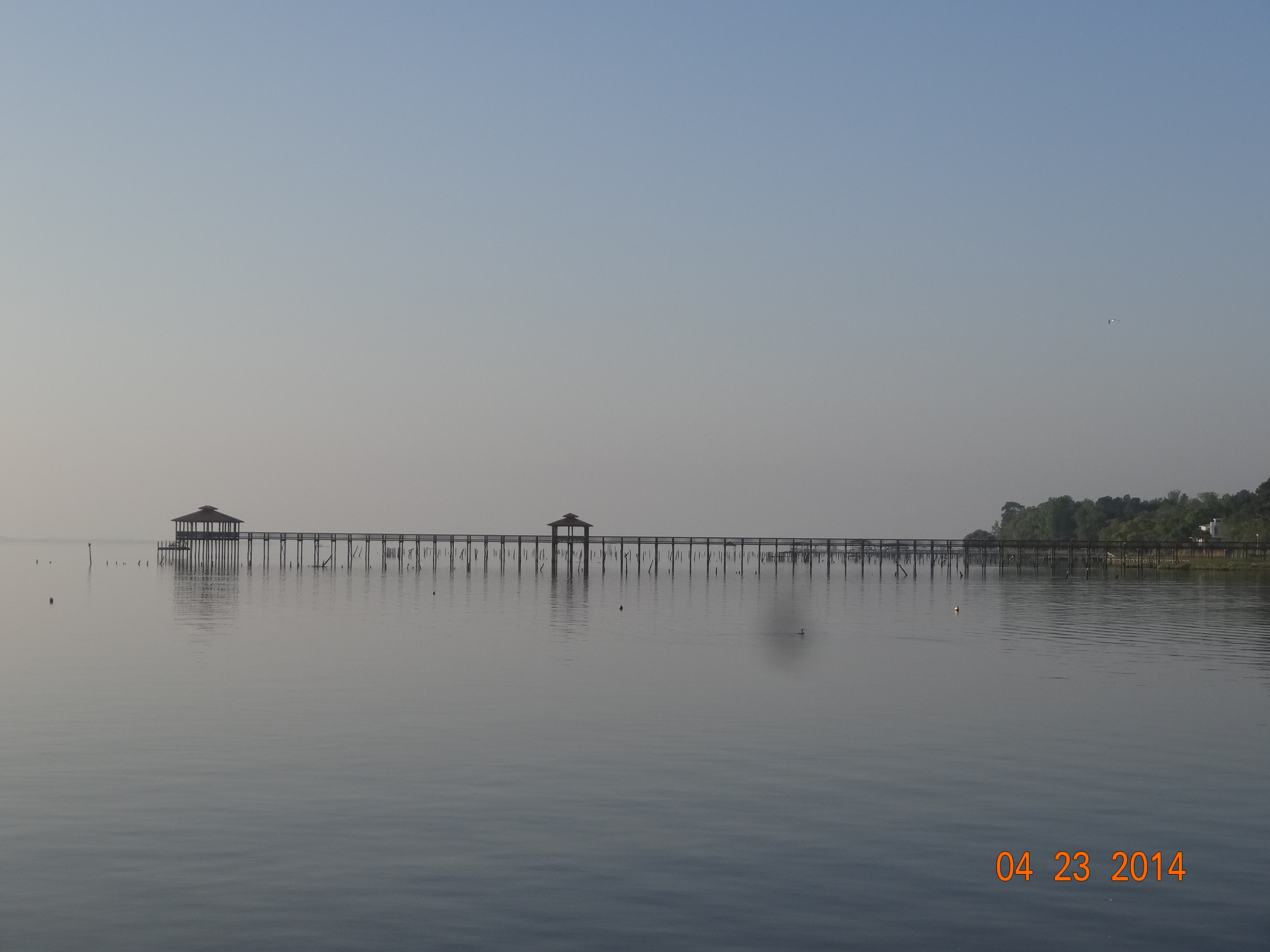
A little foggy leaving Dog River Marina
Unfortunately the closer we got to the Mobile Bay Harbor, the foggier it got. This boat came out of the fog at us
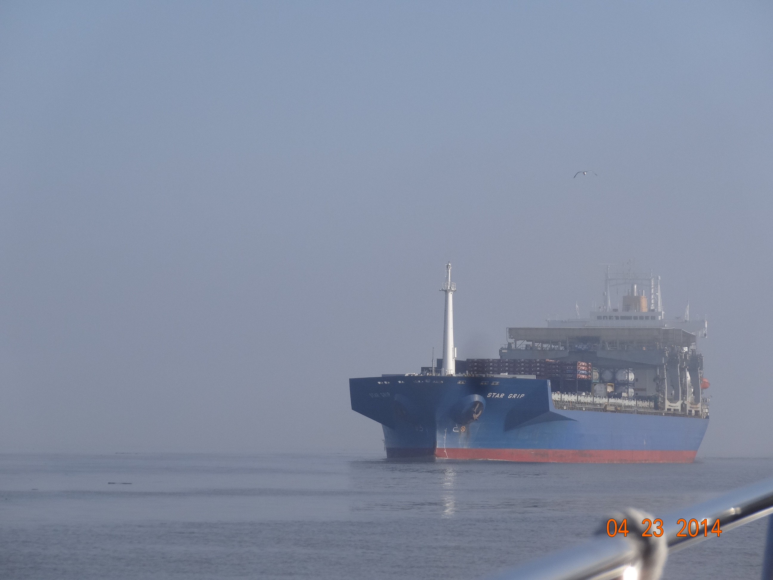
Ship coming out of Mobile Bay Harbor
Before we left Orange Beach, Gary spent several days installing the AIS (Automatic Identification System) that we bought before we left. An AIS system allows us and other boats that have AIS to “see” the boats on their navigation systems, several miles away. If you register your AIS, your boat name and vessel type will also appear on the blip on the screen that is your boat. We figured after meeting a few tugs on the sharp corners of the TennTom, we’d get it installed to save on some gray hairs.
After much swearing, bleeding and yelling, he finally got the wires strung between the bottom station and the arch where the antenna was. We had to install a separate antenna for the AIS. I offered to help but when it was apparent I was more hindrance than help, I made myself scarce until he was done. Then I fixed him a drink and bandaged him up 🙂
Well anyway, back to the story……all the ships in the Harbor were “seeing” the Touch of Class on their AIS systems. The big ship that came out of the fog called us on channel 16, the hailing channel on the marine band, and told us other ships were trying to get a hold of us and we should switch to channel 13 to monitor the activity in the harbor. He also told us there was an out going ship behind him that was trying to get a hold of us. We switched to channel 13. We were hailed by a Navel vessel. By this time I was sitting on the fly bridge with the binoculars so I could be a second pair of eyes for Gary. The fog was really thick now and the binoculars weren’t any help. Luckily Gary had installed that AIS, that was really helping him. I told Gary to turn on the Radar which would show us other objects not being picked up by the AIS. Gary was busy watching the all the navigation systems to make sure we didn’t run into anything, to keep us in the channel and stay out of everyone’s way and make sure we don’t run into anything. The Navel vessel told us to go on his ones, which means we should pass to the right of him. Gary told the guy we were hugging the reds, which were on the right side of the channel. We are going along real slowly, all of a sudden a 150 foot Navel vessel is crossing our bow! Holy Smokes! I yelled at Gary to make sure he saw it. Needless to say both Captains hit the breaks and threw their boats in reverse. Gary called him and told him to go ahead, the Navy boat said, no we should go ahead. The Navy boat turned more to his right so we could pass on his ones. What the heck????? You’re a Navy boat…..what were you doing crossing our bow? Crazy. We inched along looking visually and at the navigation systems to make sure we didn’t have anymore close calls. As we got closer to shore the fog lifted and we could finally see the City of Mobile. Whew! We made it. That was an adventure I don’t care to repeat again.
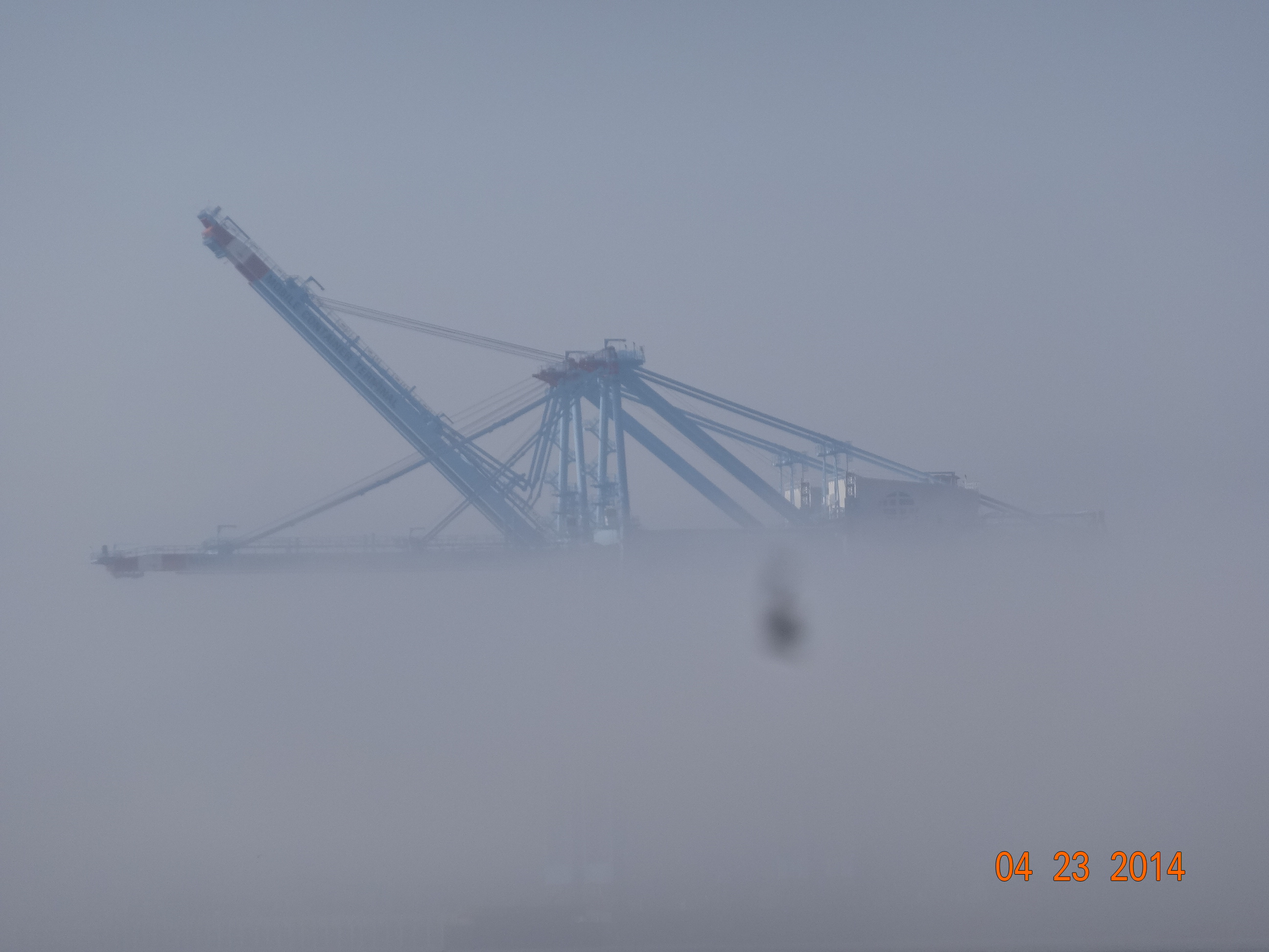
Picture taken as we left the fog. This thing is several stories high
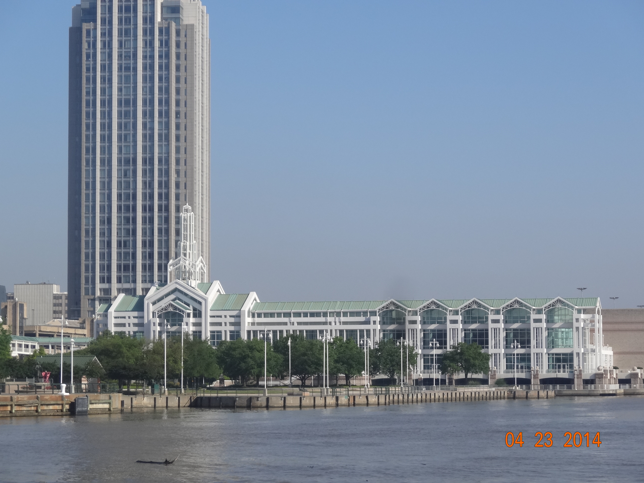
City of Mobile
I have posed some more pictures on the more picture page.
The current wasn’t too bad traveling up the Black Warrior but we still used two engines so we could make some time. We arrived at our first anchorage at 5:00, Alabama Cut Off. Here is what it looks like today
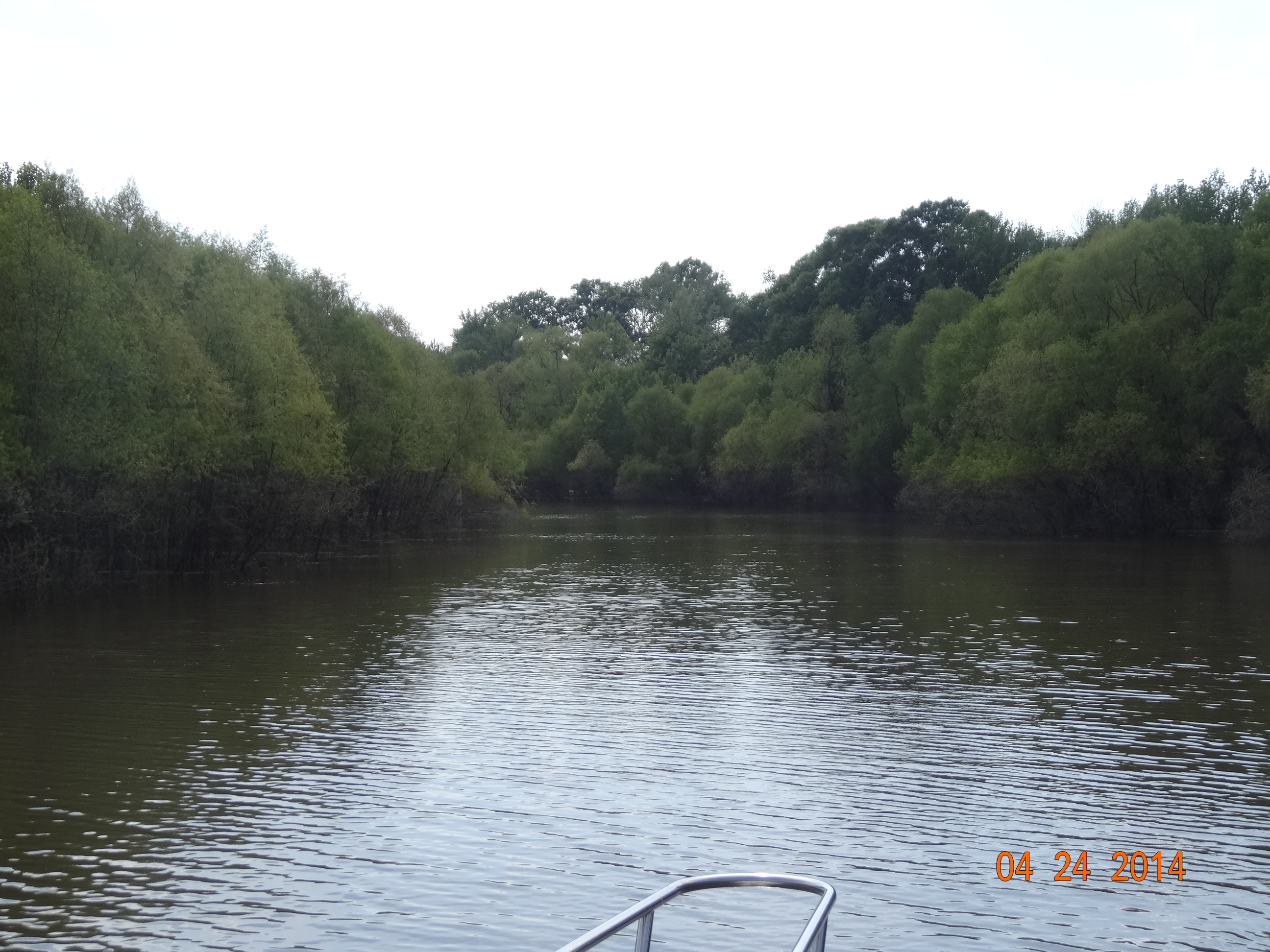
Alabama River Cut off Today in April
Here is what it looked like in January.
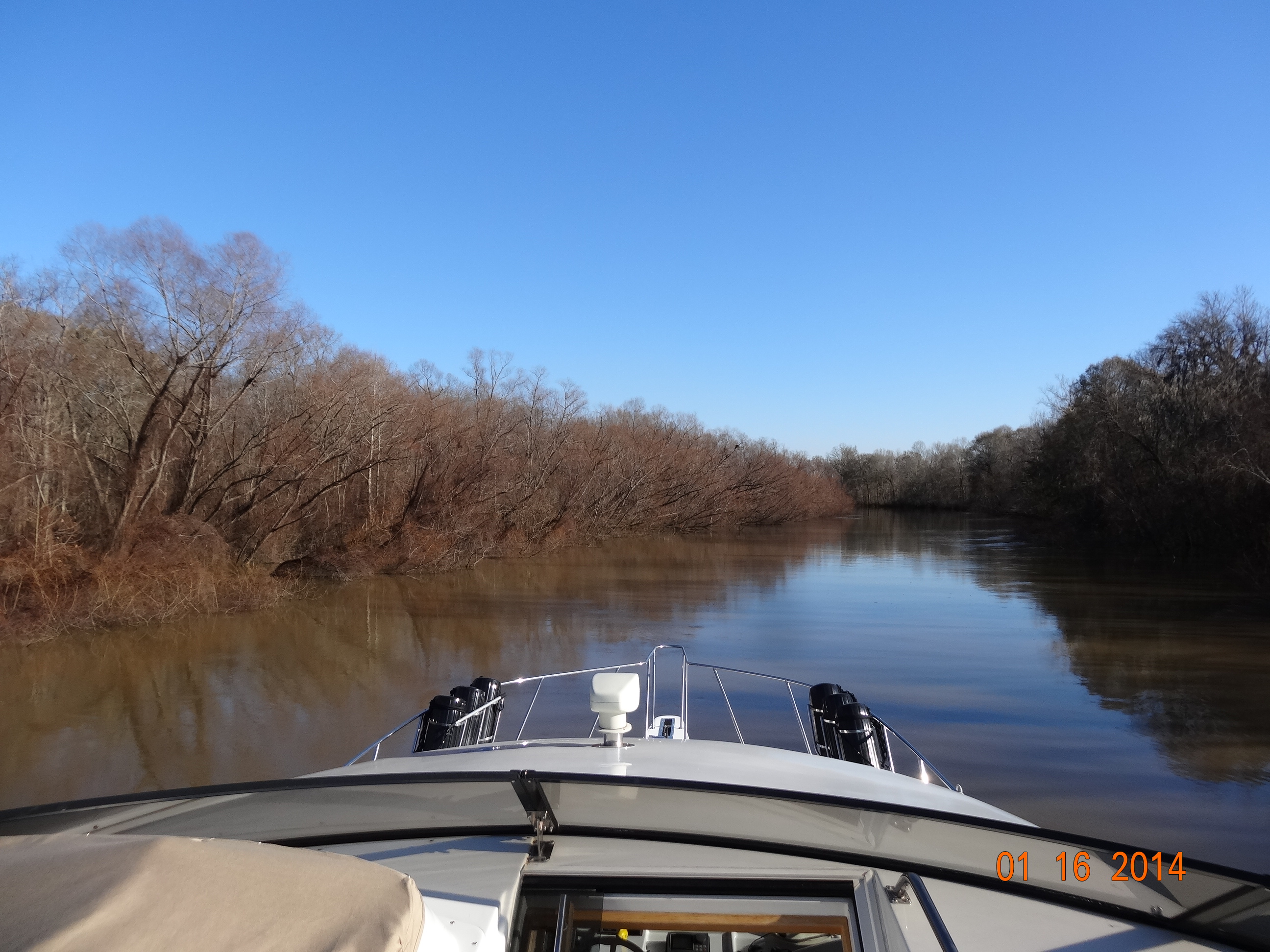
Anchorage looking out bow
Quite a difference huh? Can you tell it is spring?
We woke up at 6:00 to in dense fog. Boo! Looks like we will be sitting here a while. The picture below is looking out to the river. You can’t even see the other bank which is not that far away.
Dense Fog at Alabama Cut off anchorage
So we had to hang around here till it cleared off at 9. We’ll have to change our plans because Bobby’s Fish Camp is not doable today. We’ll try a new anchorage, Old Lock One it’s called. That is one thing about traveling by boat, you have to be flexible and have a back up plan and don’t have a schedule that can’t be changed. Ahhhhh, the life of a live aboard :).

What ???? No pic of the ship crossing the bow ???
I know! I was pretty freaked out and too busy watch everything to make sure we didn’t hit anyone. Maybe next time:)
SO glad you hooked up the AIS Gary! Well Done! Guessing the Navy Captain may’ve thought “Oh Crap!” (or some other more colorful words)
Hoping Smokie is getting his sea legs back.
Glad you’re going to sit out the next few bad weather days in a safe port!
Gary is VERY impressed with the AIS. It has really worked out well in our travels.